DO YOU HAVE ANY QUESTIONS?
THANKS!
REQUEST HAS SENT
WE WILL CONTACT YOU SHORTLY


SERG TOMAKH
DEVELOPMENT MANAGER
Or contact us via email hello@omegarender.com

Making Strategic Infrastructure Visible:
3D Visualization Project Solution in the Era of Energy Disruption of the Strait of Hormuz
When infrastructure fails at a global scale
In early 2026, the disruption of maritime traffic through the Strait of Hormuz exposed a structural weakness long acknowledged but never fully addressed. Nearly one-fifth of the world’s oil supply was suddenly constrained. There are, of course, many political reasons, but what concerns us in this article is that the system lacked viable alternatives.
What had been treated for decades as a geopolitical scenario became an operational reality. But the crisis revealed something deeper than vulnerability. It revealed a gap in how global infrastructure is conceived: a dependence on singular routes without spatial redundancy, and a lack of clearly articulated alternatives at scale.
At this level, the challenge is how to build new systems and how to understand them before they exist.
The Real Challenge
Proposals to bypass critical chokepoints are not new. Pipeline expansions, inland corridors, and even canal-scale interventions have long been part of strategic discussions, often drawing comparisons to infrastructural precedents such as the Suez Canal.
But these ideas are often abstract. They are diagrams, feasibility studies, policies, technically valid but spatially distant. Infrastructure at the national and transnational scales is difficult to comprehend: too large, too complex, too layered to be intuitively understood by more conventional means. This creates a paradox. The more critical the infrastructure, the harder it becomes to communicate.

From strategy to spatial vision
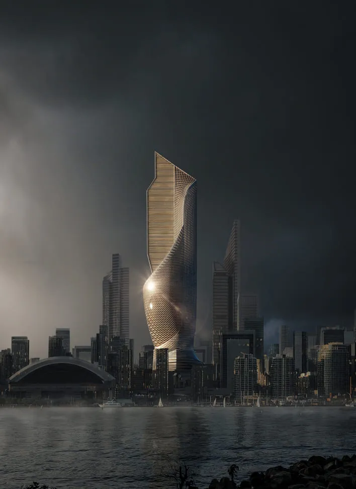
Within this context, speculative design begins to play a different role. Conceived by ZNERA, Strait of Union is an imaginative infrastructure initiative that imagines the transformation of a sovereign inland marine passage within the United Arab Emirates. It considers the potential for linking the Persian Gulf and the Gulf of Oman via a managed, internal water channel. This would result in a viable substitute for foreign maritime passages.
At the territorial level, the idea goes past a simple infrastructural structure. It perceives the passage as a national infrastructure network: a logistics backbone, a pipeline for energy, and a driving force for urbanization.
It does not react to a specific situation but seeks to design infrastructure that anticipates systemic risk.
Our role: making complexity legible
Omegarender was commissioned to visualize the project. The task was to define the infrastructure and to translate it. So, our studio took a strategic, large-scale concept and made it spatially legible across multiple levels of understanding. This meant working simultaneously with territory, system logic, and human experience.
The challenge was one of scale and of coherence, how to represent a 100+ kilometre corridor crossing varied landscapes, integrating logistics, urban development, and environmental transformation? And still allow it to be read as a unified idea? Visualization, in this context, becomes more about structuring perception.
Make your large-scale vision clear, structured, and decision-ready


What needed to be visualized
The complexity of the project required a layered approach. At the macro level, the corridor operates as a territorial system, a continuous infrastructural axis cutting across desert and mountainous terrain. Its alignment, routing logic, and relationship to existing urban centres needed to be clearly articulated.
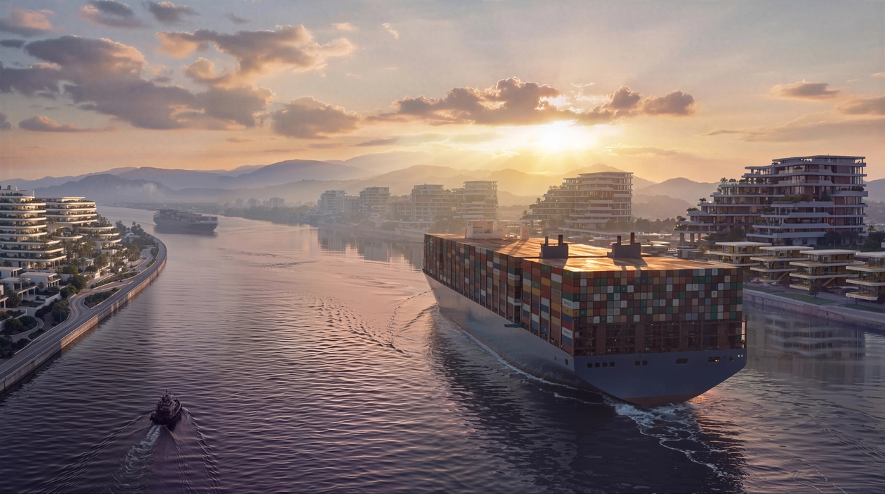
At the meso level, the project unfolds as a network of nodes: logistics hubs, bridges, and waterfront districts. Here, questions of density, connectivity, and rhythm come into play.
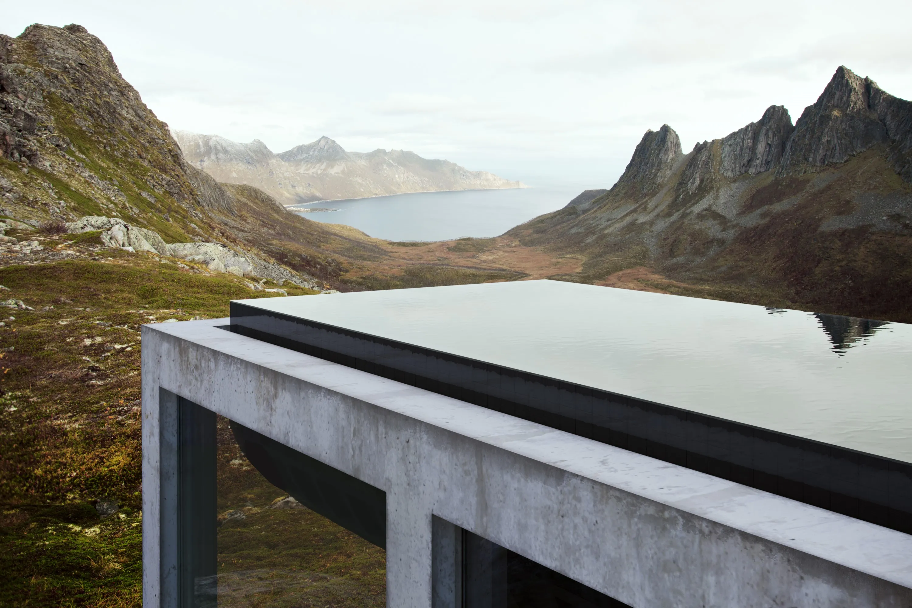
At the micro level, the focus shifts to experience how the infrastructure is inhabited, perceived, and used. The canal transitions from an abstract line into a lived environment.Together, these layers define not a system of systems, one that must be understood simultaneously at multiple scales.
Visual language: between performance and perception
To communicate this complexity, the visual strategy was structured as a hierarchy of viewpoints, moving from the territorial scale to human experience.
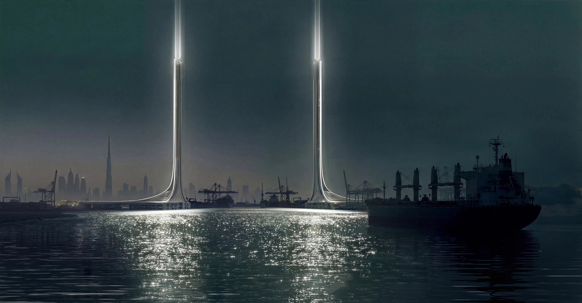
High-altitude, bird’s-eye perspectives establish the canal as a primary spatial axis — a continuous line organising the surrounding landscape. At this level, the project is read as infrastructure: a system with direction, scale, and geopolitical intent.
Mid-level aerial views translate this abstraction into spatial relationships. The corridor begins to reveal its internal logic: the rhythm of development, the interaction between both shores, and the density and distribution of built elements.At eye level, the system becomes an environment. The canal itself is no longer seen as just a diagram but as a place, traversed, inhabited, and experienced.
In all scales, composition becomes key. The canal always serves as an organizational line in the frame, defining perspective and providing depth while also organizing visual emphasis. The use of bridges and vertical lines as accents adds rhythm and orientation throughout.
Depth and clear layering also aid in creating the clarity: the use of atmosphere and light gradients creates clear visual layers, allowing intuitive understanding of scale without the use of annotations.
On the other hand, the visualizations retain the formal consistency: fluid shapes and repeating motifs, as well as architectural sculptural elements, are defining features in creating a unifying visual identity.
From diffuse daylight ensuring legibility on the larger master plan scale all the way to the dramatic atmosphere that allows for emphasizing materials, depth, and spatial relationships.The end result is harmony between showing the actual performance, structure, and function of the design while also delivering a cohesive and compelling visual experience.

Why this matters now
While Strait of Union was conceived as a speculative proposal, its relevance has shifted.
The recent disruption around the Strait of Hormuz has accelerated conversations that were, until recently, largely theoretical. Governments, analysts, and energy stakeholders are now actively reconsidering inland corridors, pipeline expansions, and alternative export routes.In this context, projects like Strait of Union operate differently. They are no longer distant scenarios. They become spatial references and ways to think through what such infrastructure could mean in practice: how it might integrate with territory, how it could scale, how it would be experienced.
Visualization as a strategic tool
At the scale of national infrastructure, decision-making depends on more than technical feasibility. It requires alignment between stakeholders, clarity of intent, and the ability to communicate complex systems across disciplines.
This is where visualisation becomes critical. Without it, projects remain fragmented across documents, models, and projections. Their implications are understood in parts, but rarely as a whole. With it, they become coherent.Visualization allows infrastructure to be seen as an integrated system, connecting logistics, urban development, environment, and experience within a single frame of reference. In this way, visualiяation enables strategy.

From abstraction to shared understanding
One of the key outcomes of the project was the ability to move the discussion from abstraction to perception. Instead of imagining a 100+ kilometre corridor through technical drawings or isolated diagrams, stakeholders can engage with a continuous spatial narrative — one that reveals scale, structure, and impact simultaneously.
This shift is subtle but significant. Infrastructure of this magnitude is rarely limited by engineering alone. It is shaped by how convincingly it can be articulated, communicated, and understood across different audiences: from planners and investors to policymakers and the public. Clarity becomes a form of feasibility.
Positioning visualization within future infrastructure
As global systems become more interconnected and more vulnerable to disruption, the role of infrastructure is evolving. It provides resilience, adaptability, and strategic independence.
Projects that address these challenges operate at increasing levels of complexity — geographically, technically, and politically. As a result, the tools required to develop and communicate them must evolve as well.Visualisation, in this context, becomes part of the thinking process itself.
Conclusion
Strait of Union, created by ZNERA and visualized by Omegarender, is one example of speculative infrastructure meeting real-world necessity. An initially speculative idea takes on real value in today's global discussion of energy security and the continuity of trade.
From the perspective of Omegarender, it is one of the directions that they have recently been following, trying to visualize complicated processes and systems.In an era of increasing importance of infrastructure issues, it becomes crucially important to see those infrastructures and make them tangible.
Turn complex infrastructure into clear, compelling visual strategy


.webp)

REVA SYKE RD, BRADFORD, UK
D3, DUBAI DESIGN DISTRICT,
DUBAI, UNITED ARAB EMIRATES


