DO YOU HAVE ANY QUESTIONS?
THANKS!
REQUEST HAS SENT
WE WILL CONTACT YOU SHORTLY

SERG TOMAKH
DEVELOPMENT MANAGER
Or contact us via email hello@omegarender.com

Urban Planning Rendering: Enhancing City Development with Visual Precision
What is Urban Design Rendering?
Urban design rendering is a sophisticated technique that visualizes development projects in photorealistic 3D models. It plays a vital role in illustrating how urban areas will be developed, showing city infrastructure, public spaces, and architectural elements in a highly detailed and accurate way. Architectural visualization allows city planners, architects, and real estate developers to present large-scale projects with clarity. By simulating the interaction between buildings, streets, and landscapes, these renderings help clients understand how projects will transform urban environments.
For any urban design plan rendering, the focus is on more than just visual appeal. The rendering must accurately reflect the technical specifications of the project, including building height, zoning regulations, and transportation systems. This form is essential for communicating complex urban designs to both technical teams and the public.Urban design is also often complemented by 3D exterior rendering services, which further enhance the realism of the building exteriors, making these renderings ideal for commercial and residential projects.
Elements of Urban Planning Rendering
Architectural visualiaztion incorporates several critical elements that provide a holistic view of how city development projects will fit within existing infrastructure and environmental contexts.
Buildings and Structures
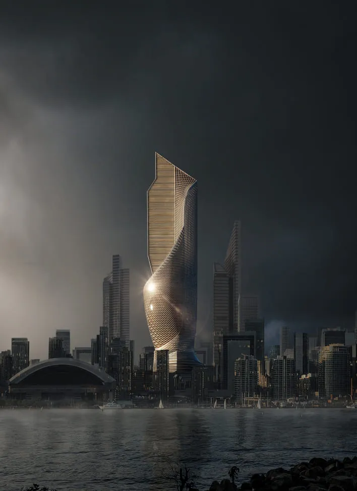
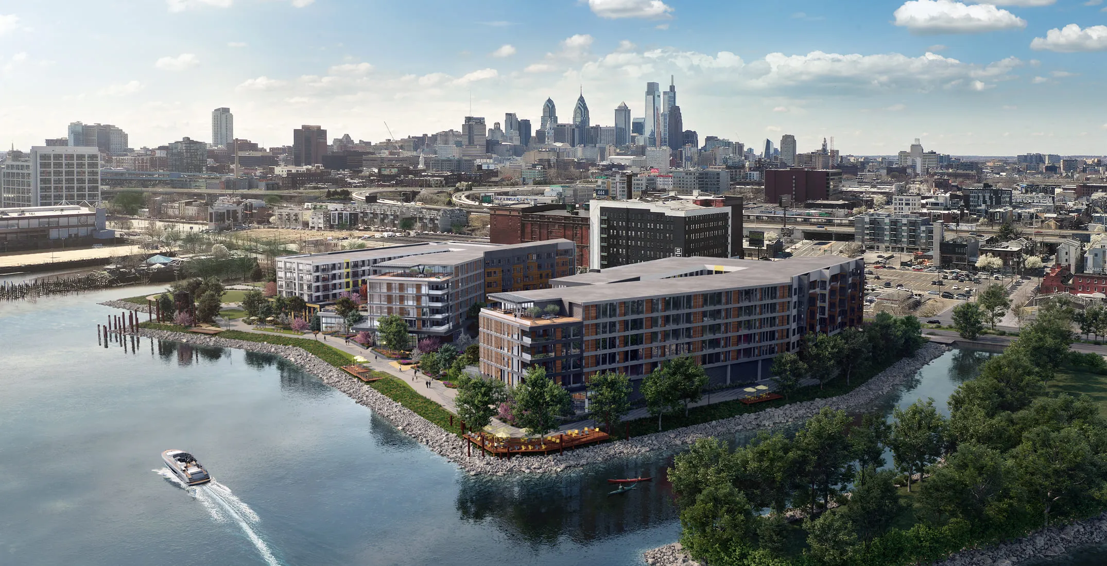
Accurate 3D renderings of buildings help planners and developers visualize the relationships between new and existing structures. By integrating photorealistic models into the surrounding environment, clients can understand how new construction will impact cityscapes and skylines. Read our guide on skyscraper rendering.
For projects that focus on larger commercial structures, commercial architectural 3D rendering services are frequently employed to provide accurate depictions of large-scale developments.
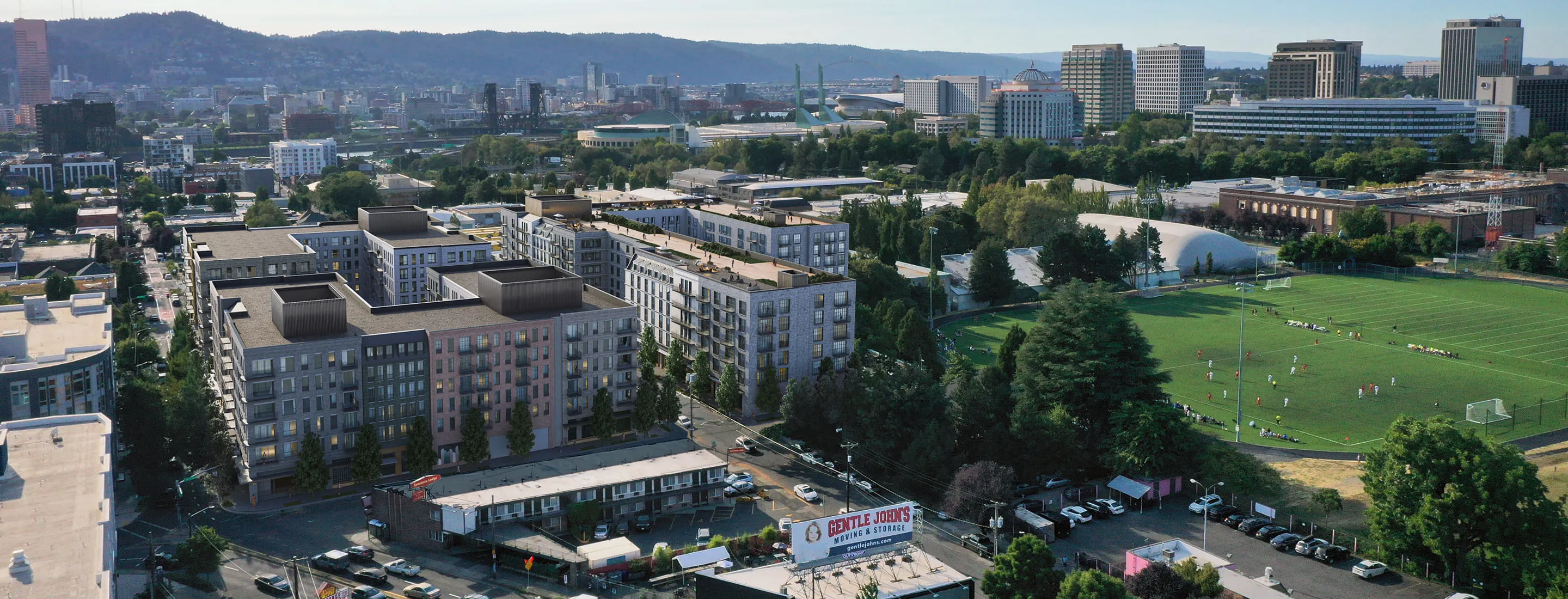
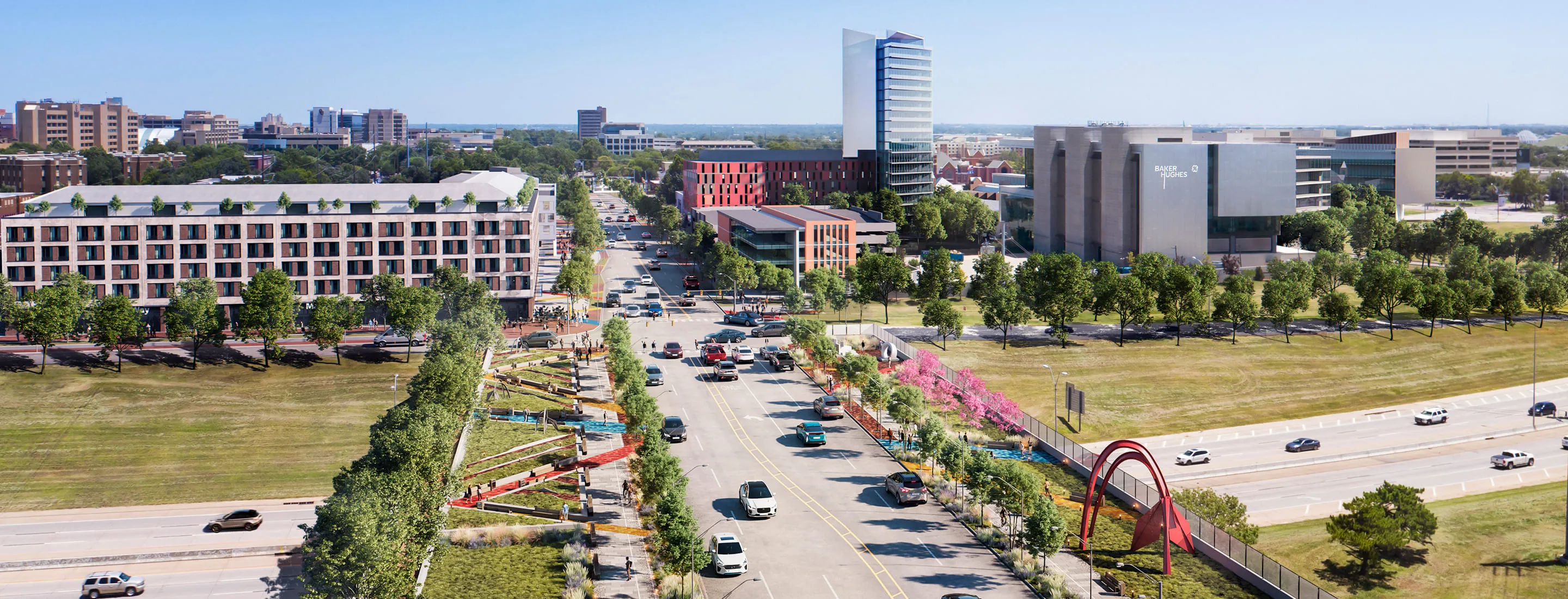
Landscaping and Public Spaces
Public spaces are a significant part of urban development projects. Parks, streetscapes, and plazas must be thoughtfully designed to foster community interaction and aesthetic appeal. Streetscape rendering ensures that pathways, green areas, and open spaces are visually represented, showing how they integrate with the broader urban design. For projects involving residential or mixed-use developments, 3D real estate renderings or 3D House Rendering Services are often utilized to bring the vision to life and enhance the project's appeal to stakeholders.
In some cases, additional tools like virtual staging services are used to showcase how these public spaces will look once fully developed, offering a clear vision of future community spaces. For projects that require a detailed representation of natural elements, consider using professional Landscape Architecture Rendering services to enhance the realism and functionality of outdoor spaces.
Read more on staging outdoor spaces.
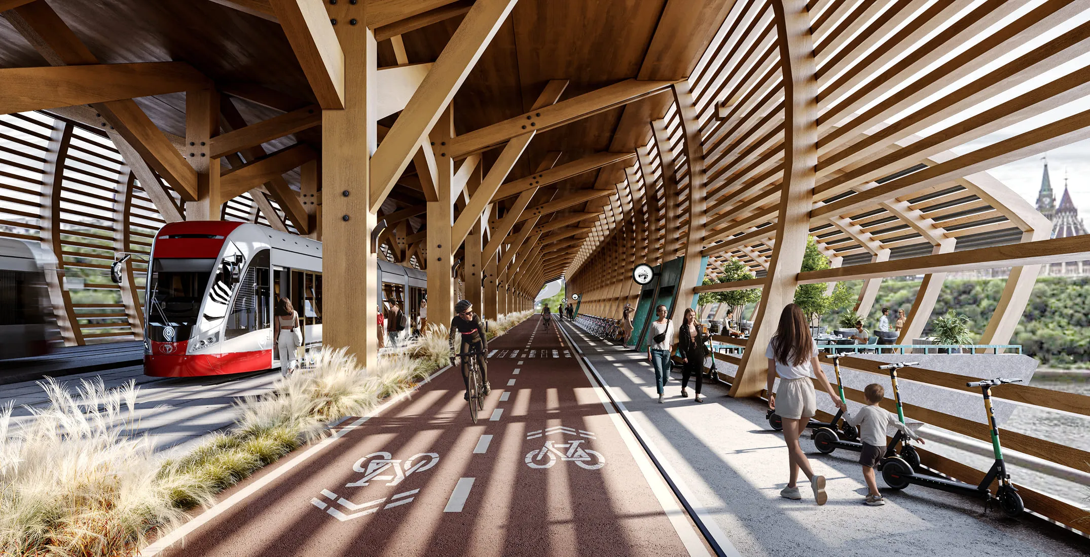
Transportation Systems
Effective urban planning cannot happen without considering transportation systems. Roads, pedestrian walkways, and public transit routes are integral to any urban design project renderings. Visualization of these systems allows for a thorough evaluation of accessibility and convenience in city planning.
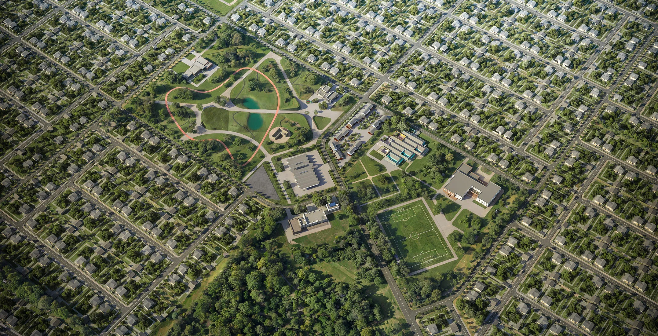
Zoning and Spatial Layout
Zoning maps and spatial layouts help urban planners divide the project into specific areas—residential, commercial, or recreational. Urban design rendering aids in visualizing these divisions, ensuring that land use regulations are adhered to while maximizing urban efficiency.
For more intricate zoning details, 3D site plan rendering services are often employed to provide a clear view of the entire project’s layout.
ENVIRONMENTAL IMPACT
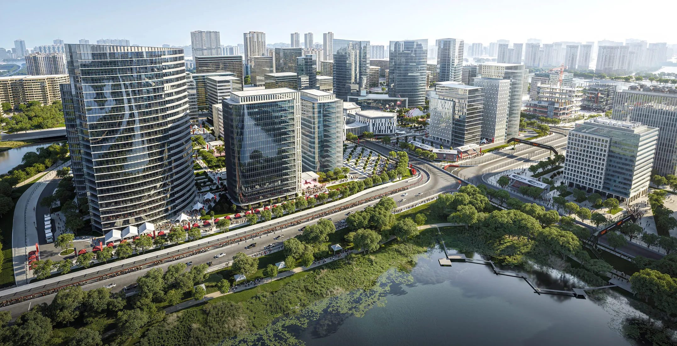
Architects need to account for environmental factors when planning new developments. Visualizations that depict green spaces, water bodies, and topography help clients understand how the project will affect the environment and support sustainable development. Sustainable architecture renderings are especially useful in this context because they help planners show how buildings, green infrastructure, water systems, and public spaces interact within an environmentally responsible urban plan.
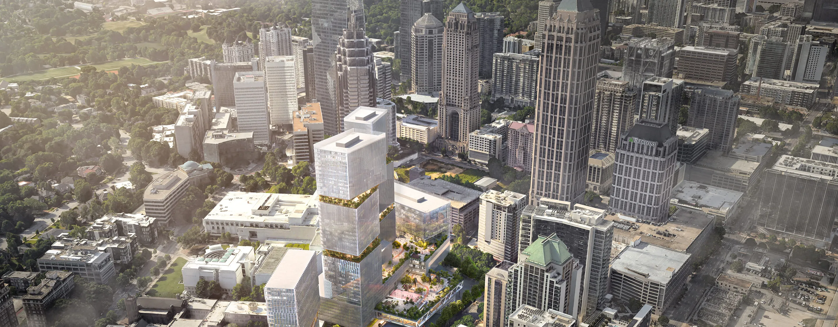
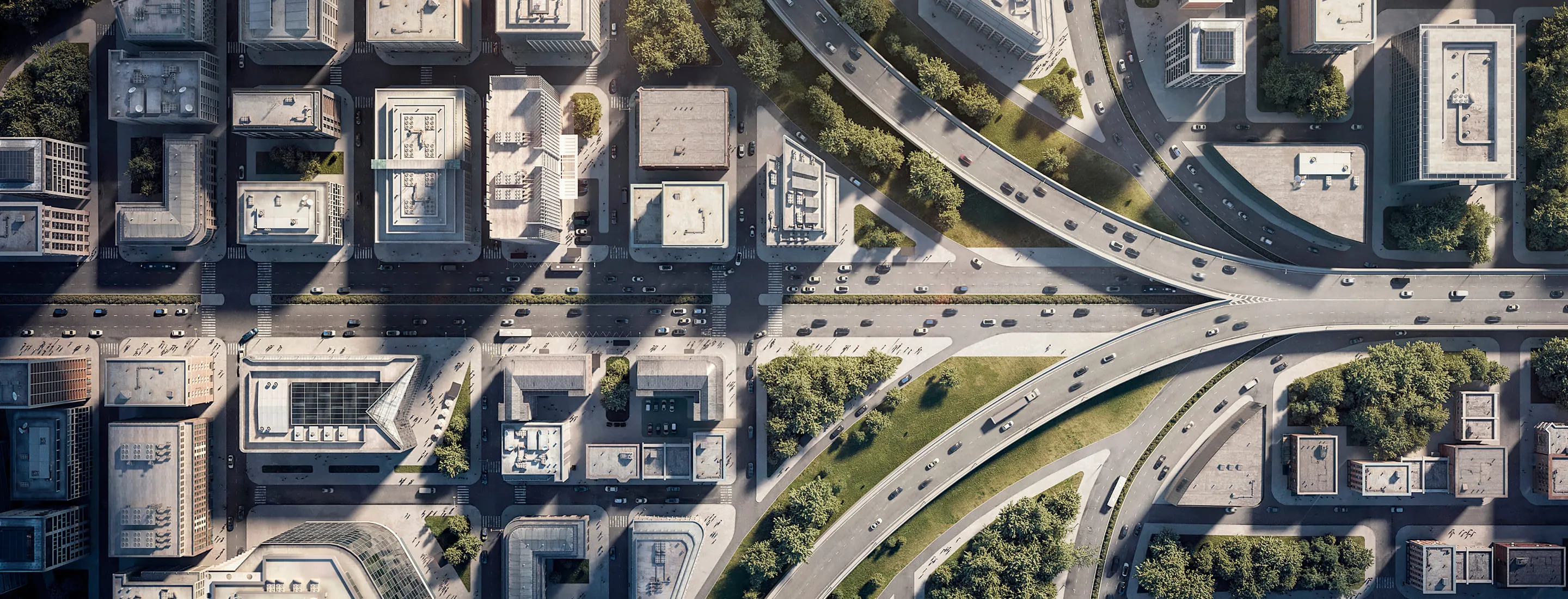
Additionally, 3D aerial view rendering services are a powerful tool in visualizing the broader context of an urban development, allowing potential clients to see how the entire project fits into the landscape from above.
Benefits and Challenges of Urban Design Rendering
Architectural visualization is essential for modern city development, but it comes with both significant benefits and challenges.
Benefits
1. Enhanced Communication: Urban planning renderings make complex projects easy to understand for both technical and non-technical stakeholders. Detailed visuals ensure clear communication, whether presenting to government officials or the general public.
2. Better Decision-Making: Photorealistic renderings provide city planners and developers with insights into the long-term impact of their projects, facilitating more informed decisions on zoning, infrastructure, and community spaces.
3. Increased Public Engagement: Urban planning visualizations help engage the public in city development. By offering tangible renderings, planners can explain changes to the city’s layout and encourage community feedback.
4. Faster Approvals: Detailed renderings aid in speeding up regulatory approvals by offering city officials and governing bodies clear, visually compelling representations of proposed projects.
Challenges
1. Resource-Intensive: Creating high-quality urban design renders can be costly and time-consuming. High-performance software, skilled designers, and powerful hardware are essential for producing these detailed visuals.
2. Technical Complexity: Integrating multiple components, such as zoning, transportation, and public spaces, into a single rendering requires a high level of technical expertise.
3. Iterative Revisions: Urban planners often need to make changes based on feedback, leading to multiple revisions of the render, which increases the complexity of the design process.
Interested in high-quality visualizations for your urban projects? Check out 3D rendering in Houston to learn how experts can enhance your city planning efforts.
Challenges
1. Resource-Intensive: Creating high-quality urban design renders can be costly and time-consuming. High-performance software, skilled designers, and powerful hardware are essential for producing these detailed visuals.
2. Technical Complexity: Integrating multiple components, such as zoning, transportation, and public spaces, into a single rendering requires a high level of technical expertise.
3. Iterative Revisions: Urban planners often need to make changes based on feedback, leading to multiple revisions of the render, which increases the complexity of the design process.
5 Tips to Create a Spectacular Urban Planning Rendering
1. Understand the Full Scope
The success of an urban design rendering hinges on a detailed understanding of the project. Gather comprehensive data, including architectural plans, transportation layouts, and environmental considerations, before starting the rendering process.
2. Focus on Realism
Use advanced software like 3D rendering tools such as Lumion, V-Ray, and AutoCAD to create realistic lighting, shadows, and textures. A well-executed urban render helps stakeholders visualize the project as it would appear in real life.
3. Incorporate Environmental Elements
Always integrate natural features like parks, rivers, and trees into your urban visualizations to give a full picture of how the project will interact with its environment.
4. Highlight Public Spaces
Effective streetscape rendering is crucial for showcasing public spaces like parks and plazas. These areas are essential for urban dwellers and should be clearly highlighted in the render.
5. Show Multiple Perspectives
Use various viewpoints, including aerial shots, street-level views, and bird’s-eye views, to fully demonstrate the scope of the project. This will ensure that all elements of the urban design project renderings are well understood.
How Long Does It Take to Create Urban Planning Renderings?
The timeline for creating a city planning rendering depends on the complexity of the project. For smaller projects, the process may take 3 weeks, while larger-scale urban projects can take several months. The number of buildings, transportation elements, and public spaces, as well as the required revisions, directly impact the timeframe.
Costs of Making City Design Renderings
The cost of 3D visualization varies depending on the project’s scope and complexity. Factors such as the size of the development, the number of revisions, and whether the render includes animations will also influence the overall price.
Leave your request or question using the Contact Us form or book a call at a convenient time using the Schedule a Call form on our website.
Why Choose OMEGARENDER?
Omegarender has expertise in creation of high-quality urban design rendering services. Our team of experts ensures that every project is approached with precision and attention to detail. Whether you need a comprehensive urban planning rendering or a specialized streetscape rendering, we tailor our services to meet the unique demands of your project.For projects requiring detailed exterior visualizations, our 3D house rendering services are ideal for showing how residential developments will look within an urban environment.
Benefits We Offer:
•Architectural Firms: Our renderings provide a detailed view of how new developments integrate with existing cityscapes, helping architects communicate their vision effectively.
•Real Estate Developers: Full-scale visualizations show how commercial and residential projects will transform public spaces and enhance urban areas, making it easier to market properties to investors and stakeholders.
•Civic Developers: Precise, scalable renderings help government bodies and public entities visualize large infrastructure projects, ensuring regulatory approval and public support.
•Urban Planning Design Firms: We create detailed breakdowns of zoning and transportation systems, allowing for comprehensive urban growth strategies that can be easily communicated to city officials.
FAQ
What are the best software tools for urban planners?
Our studio relies on software and 3D rendering programs like Coronarenderer and 3ds Max. These tools offer the precision and realism needed for high-quality visualizations.
What is urban planning rendering and how does it aid city development?
This type of rendering creates detailed 3D visualizations of city projects, showing how buildings, public spaces, and infrastructure will integrate. It helps developers and planners communicate their vision clearly and ensures that stakeholders understand the impact of their projects.
How do urban planners use rendering technology to simulate different design scenarios?
Planners use architectural visualizations to model various scenarios, such as changes to transportation networks or public spaces. These simulations allow planners to test different designs and assess their long-term impact on the city.
What are the key features to focus on when creating renderings for urban design projects?
Focus on photorealism, accurate transportation systems, public spaces, and environmental sustainability. Urban renders should clearly represent all aspects of the project, including buildings, zoning, and public areas.
How does urban design rendering impact public engagement and policy-making?
City planning renderings make it easier to engage the public by providing tangible visuals of urban projects. They also aid policy-makers in making informed decisions by clearly showcasing the long-term benefits and potential challenges of new developments.
REVA SYKE RD, BRADFORD, UK
D3, DUBAI DESIGN DISTRICT,
DUBAI, UNITED ARAB EMIRATES


